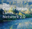
What is the Conservation Lands Network?
The Conservation Lands Network (CLN) is a regional conservation strategy for the San Francisco Bay Area, with a set of goals and science-based decisionmaking tools that support strategic investments in land protection and stewardship. These tools focus conservation in areas that represent the region’s biodiversity and support ecological function across the nearly 5 million acres that comprise the 10 Bay Area counties.
Updated in November 2019, CLN 2.0 equips the Bay Area to respond to climate change, connect landscapes, and connect upland and bayland conservation.
Regional Conservation Goals
The regional land conservation goals identified in the Conservation Lands Network 2.0 project are the following:
- Conserve 2.5 million acres of priority lands by the year 2050.
- Conserve rare, diverse, and irreplaceable landscapes, and manage them for health and resilience.
- Conserve core habitats and the lands that connect them, and manage them for permeability, health, and resilience.
- Conserve a regional network of streams, wetlands, ponds, seeps, and associated riparian and upland areas, and manage for health and resilience.
- Steward all lands to maintain ecological and hydrological processes that support ecosystem function and resilience.
Use the tools of the Conservation Lands Network:
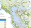
Progress Dashboard
Track regional and county-level progress toward regional conservation goals.
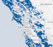
Explorer
Use this interactive map with 45 data layers to explore the network of essential lands, and generate a detailed conservation report for any specific point or area.
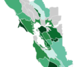
Maps
Download any of 27 of regional maps showing various biogeographic and human datasets.
Reports
Learn more about the CLN goals, how the network was created, resources at stake, and conservation actions.
Datasets
Download~100 up-to-date GIS datasets including biotic inventories, climate, geographic data, and political boundaries.